In our adventures, we finally reached the end of the land. And it is easier to get there than you can think.
Forillon National Park
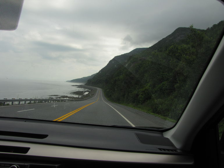
Forillon National Park is located 770 km from Québec City, at the northeast tip of the Gaspé Peninsula. And it is one of the three National Parks of Canada in Quebec.
This day we had a long drive from Sainte-Anne-des-Monts to the park. With the final destination for this day to stay for the night in Gaspe.
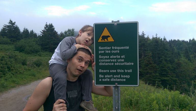
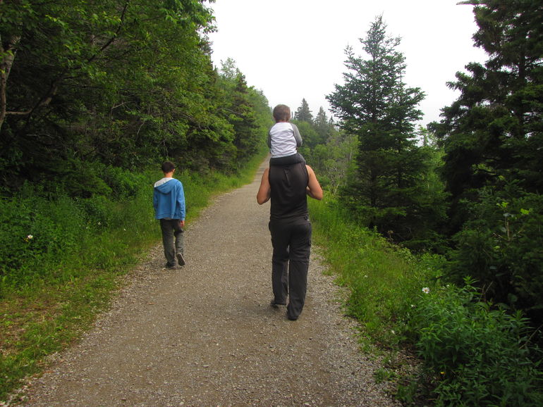
The park offers a variety of activities, including 12 hiking trails of all levels. So no matter whether you are a strong hiker or visit the park with small kids, you can find a hike which suits you.
One of the popular trails is the Mont-St-Alban. The 2km climb is constant but the views from many lookouts along the way supposed to be stunning. So definitely worth the effort. The highest point is the 15-meter tower on top of one of Forillon’s highest mountain, which offers a 360-degree view. The trail continues, but it is mainly the walk in the forest. So the rest of the trail could be skipped. Unfortunately, we didn’t make this trail as the weather was extremely bad with very low visibility.
Stats of the Mont-St-Alban trail
Length: Loop: 7.8 km – Tower and back: 3.6 km
Duration: Loop: 3 – 4 hrs. – Tower and back: 2 hrs.
Elevation gain: 245 m
Trailhead: Cap-Bon-Ami
GPS coordinates: 48.809272° N, -64.22125° W
Note: The gravel trail is also open to bikes
From all the hikes offered by the park, we decided to go for the last part of t

The Trail to the End of the Land
The Les Graves trail crosses through woods and fields with the views on coves and the sea. And if you are lucky, you could see some marine mammals, bears or porcupines.
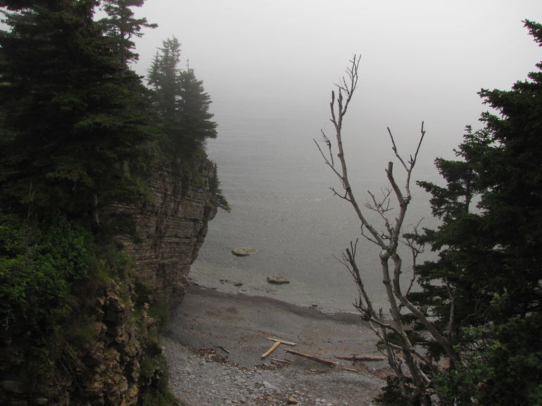
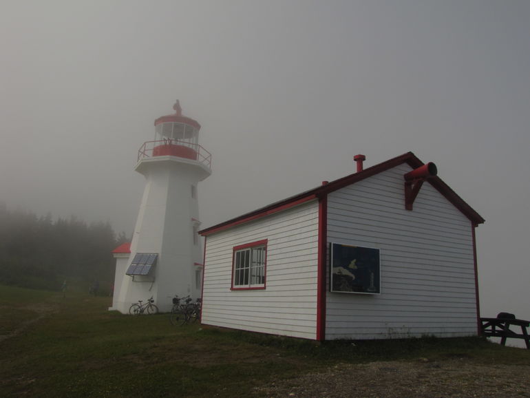
At Cap-Gaspé (or Shiphead), you approach the base of the lighthouse located atop a 95-meter-high cliff. Nowadays, this solar-powered lighthouse is fully automated.
Follow the trail down to the bottom of the cliff until reaching Land’s End!
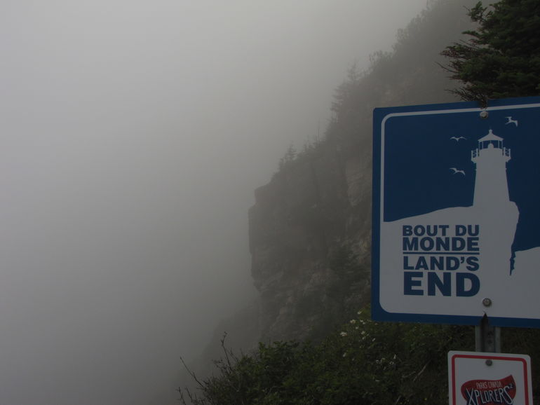
If you are lucky, you will be able to see the beautiful scenery. Here you can take a snack before going back.

Stats of the trail
Length: 8 km (round trip)
Duration: 2 – 3 hrs.
Elevation gain: 80 m
Trailhead: L’Anse-aux-Amérindiens
GPS coordinates: UTM East: 48.769181° N, -64.193448° W
Note: The gravel trail is also open to bikes
Leave a Reply