Key Takeaways
- Île-aux-Lièvres is a 13 km island with over 45 km of trails, reachable only by Duvetnor’s boat.
- One operator, one departure a day in summer, and a strict no-refund policy. Book by phone early.
- A full day gets you one loop. The east side is the realistic choice; Point West is far.
- Low tide opens up the rocky shoreline and is the best part of the hike.
- Stay two nights in Rivière-du-Loup. The 7:45 am departure makes a day trip from Montréal impossible.
It’s Canada Day and we’re off on another mini adventure. This time I picked Rivière-du-Loup, a small town on the eastern shore of the Saint Lawrence river. Usually we stop there for the night on our way to Gaspésie, but not this time.
The plan was to hike Île-aux-Lièvres. I had this island on my list for a long time, but the timing never worked out. The logistics are tricky because of the tides and the boat schedule. You really need to stay nearby for at least two nights to make a full day on the island happen.
The island is 13 km long with over 45 km of trails, and there’s only one company allowed to bring you there. This post covers everything we figured out doing it: how to book, what the crossing is like, which trails we picked, what it all cost, and what I would do differently next time.
Quick Answer
Île-aux-Lièvres is a 13 km island in the St. Lawrence close to Rivière-du-Loup, Québec, with over 45 km of marked hiking trails. Access is by boat through Société Duvetnor only, operating roughly May through the end of September, with a morning departure from the Rivière-du-Loup marina. A day trip costs about $82 per person and gives you roughly seven hours on the island – enough for one shoreline loop, not the whole island.
Quick Facts
Distance hiked: 9 km for the east loop; 13+ km if you add a second loop
Elevation gain: Minimal – this is a shoreline and forest hike, not a summit. We had one small section with the stairs but it was possible to avoid them.
Difficulty: Easy to moderate. The terrain is gentle, but heat, humidity and mud make it harder than the numbers suggest.
Duration on island: About 7 hours (07:45 departure, 16:45 return in July)
Best season: June through September – the operator does not run outside this window
Getting there: Société Duvetnor, Rivière-du-Loup marina. Boat only, no public dock access.
Cost: $81.81 per person, taxes included (July 2026)
Parking: At the departure point in Rivière-du-Loup
Facilities: Café, toilets, showers and potable water at the dock. Nothing on the trails.
Pets: Dogs and other pets are not allowed on the island. It’s a protected nature reserve run by Société Duvetnor.
How do you actually get to Île-aux-Lièvres?
On the departure day we called to reserve the boat. Only one company is allowed to go there, and the prices, as you can imagine, are quite high. They also have a bad refund policy – no matter what, no money will be returned. Without any alternatives we decided to proceed.
The plan was to depart at 7:45 am and hike on the island until 16:45.
That refund policy is not theoretical. On the morning of the trip, one of our friends couldn’t join us. The company filled the spot with no problem at all, and still refused to refund us for one person.
So: book by phone, well in advance, and treat the money as spent the moment you pay it.
The drive. It’s almost 5 hours from Montréal, so plan for some stops. Very interesting places can be as close as a few kilometres from the highway. We got off to visit Kamouraska, a small but very beautiful village on the shore of the Saint Lawrence not too far from our final destination. Worth a detour in either direction.
We stayed two nights in Rivière-du-Loup. With a 7:45 am boat, that isn’t optional.
What is the crossing like?
The ride to the island was quite bumpy. Waves and wind were pushing the boat back, but that did not stop us from going outside to get the punch of the salty water.
Just before our final destination the boat stopped near a small island and the guide told us about the habitat, the history and the preservation of the area. Around us there were thousands of small black-and-white birds flying, jumping and swimming next to the boat. They’re razorbills – le petit pingouin in French, close relatives of the extinct Great Auk. It was so cool to see.
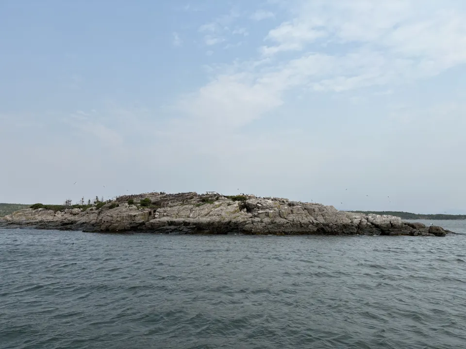
That stop takes about 15-20 minutes and nobody tells you it’s coming. It was one of the best parts of the day.
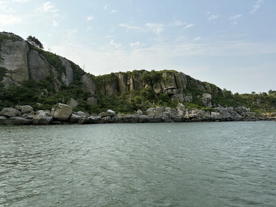
When you land, you get a briefing about the area, the tides and the timing before anyone heads out. Take it seriously – the return boat does not wait.
We grabbed a well-made coffee at the dock café and started our hike. My hope for the trip was to meet the seals. Dana wanted to see the duck nests – and here’s an interesting fact: the down from those eider nests is gathered by hand, but only after the ducks have finished nesting and left, so the birds are never disturbed. That down then becomes the insulation in duvets, and the final product is very expensive.
Which trail should you take?
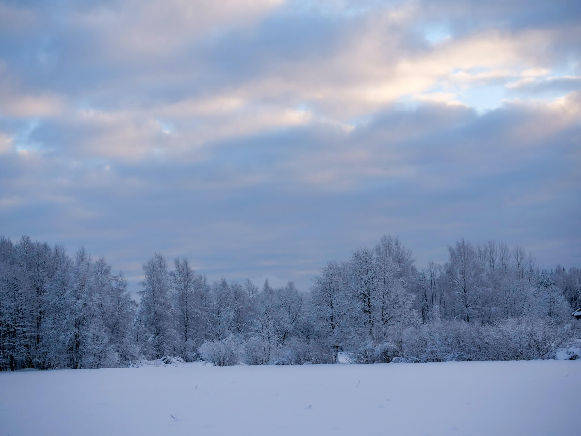
We arrived at the beginning of the low tide, which means we had an opportunity to walk as close to the water as we possibly could. If you can time it that way, do.
After some hesitation we chose the right-hand loop, with the furthest point being Point East. Point West is on the opposite side of the island and much further from the start. We had plenty of time, but the high temperature and humidity convinced us to take the shorter route. With 30°C and no wind, that was the right call.
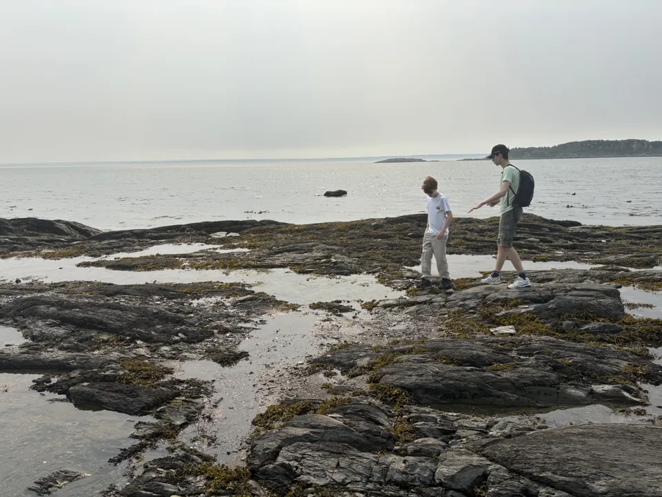
Along the shore. As you hike you see many ducks with their ducklings, and of course seagulls. The stones had not dried out yet from the outgoing water, which led to an unfortunate accident when Dana, too excited from the views, slipped off a stone. Luckily everything was fine and we could continue.
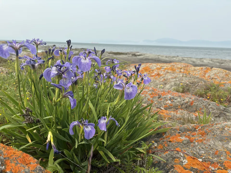
Point East. We made our first stop here to have a snack and enjoy the views of the Saint Lawrence and the silhouettes of the Charlevoix Mountains across the water. For some weird reason I am fascinated with rocks, so while everyone else was having a snack I was browsing along the shore, looking at rocks of different sizes, shapes and colours.
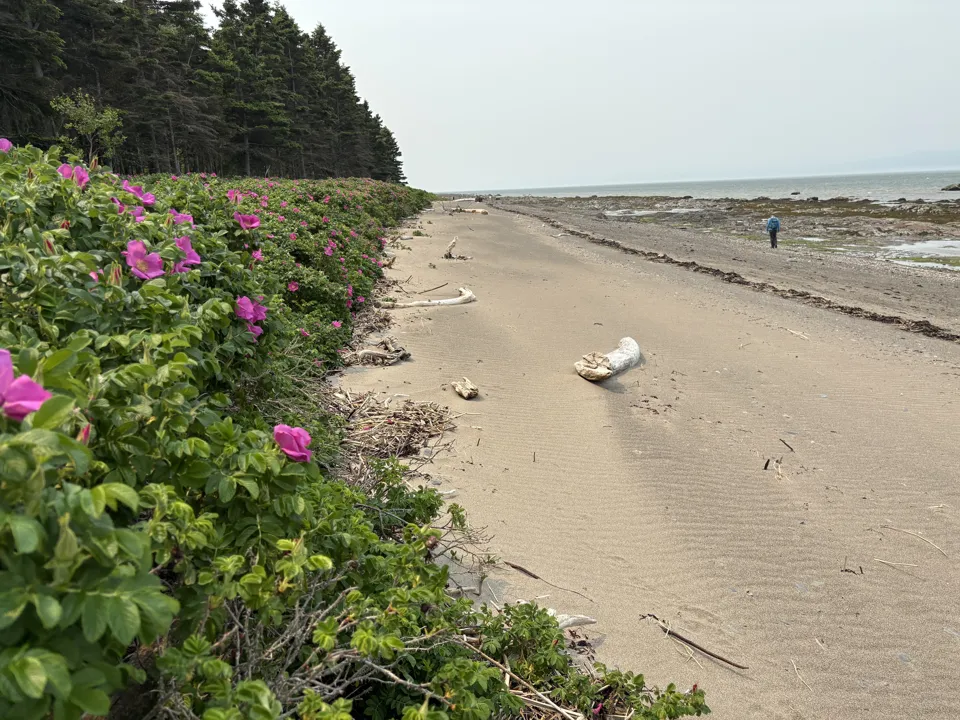
The way back. This side of the island gave us something different. No seals, but bushes of wild roses spreading as far as you could see along the shore. And huge fallen trees – definitely not from the island. The river brought them here and they found their end on this beach.
Eventually we reached the point where we had to turn inland. The hike is not difficult, but with the high humidity and no wind it suddenly became hard. To my big surprise I found something I was not expecting but was very happy to see: a king bolet. Only one, unfortunately.
The trail led us back to the starting point at about 9 km.
What do you do with the rest of the day?
We still had plenty of time until departure. Dana checked whether we could leave sooner, but the boat was already full, so we had to wait. Alex, Elliot and Maxim decided to stay at the dock and relax. Dana and I decided to add another small loop.
Most of it went through forest, and it was quite a muddy forest. I’m still wondering whether the high tide reaches that far – probably not, it’s more likely the local streams feeding it.
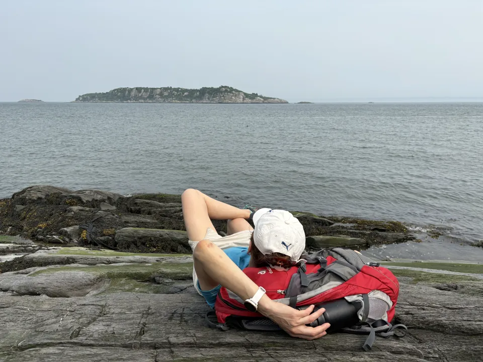
Then we found the exit to a rocky beach, and this was amazing. Just the two of us, the ducks, the view of the nearby little island, the sound of the birds and the breeze. We literally didn’t want to leave.
The rest of the hike was even muddier. We were literally walking on fallen branches. At some point we had to decide: continue to another viewpoint a few kilometres further, or take the fork back to the dock. We went back. I recorded just above 13 km for me and Dana.
At the dock the guys looked quite relaxed, playing cards. We settled near them and waited. The sun was lighting the nearby island and we spotted many sailboats chilling around.
The boat arrived, we picked the best seats, and the captain started the engine. This time the river was calmer. We could go outside not only at the back of the boat but also at the front. The island was fast disappearing, the seagulls were trying to compete with the boat, and everybody on board was happy.
Where do you stay and eat?
We stayed at Hôtel Universel in Rivière-du-Loup, about five minutes from the departure area, with a pool and a restaurant on site. A good shower after the hike removed the tiredness. The boys went to the pool and then we all had dinner at the hotel restaurant.
The night before, we bought sandwiches at the local grocery store for the island. We also had dinner in the room with our friends and brought a homemade chicken pie, which was very well received.
On the way home, skip the hotel breakfast and stop in Kamouraska instead.
Gear and logistics
- Lunch and snacks. Buy sandwiches in town the evening before.
- Water. Potable water is available at the dock, so fill up there rather than carrying it from town.
- Layers. The crossing is windy and cold on open water even in July, but the inland trails are hot and humid. You want both.
- Footwear with grip. Wet shoreline stones at low tide are slippery, and the forest sections are genuinely muddy.
- Bug protection for the forest loops.
- Camera. The razorbill stop on the crossing happens with no warning.
- Facilities. Toilets and showers are available at the dock if you need them before the ride home.
Practical tips
- Book by phone, well in advance. The boat fills up, especially on weekends and holidays.
- Understand the refund policy before you pay. No money comes back, for any reason, even if they resell your seat.
- Check the departure time for your month. It was 7:45 am in July. Arrive early.
- Stay two nights in Rivière-du-Loup. A day trip from Montréal doesn’t work with a morning departure.
- Take Point East, not Point West, if you only have one day. West is much further from the dock.
- Hike the shoreline at low tide. It’s the best terrain on the island and it disappears when the water comes up.
- Break up the drive. Kamouraska is a short detour off the 20 and worth a stop for coffee.
- Consider staying on the island. Duvetnor rents accommodation out there, two nights minimum, and that’s the version of this trip I want next.
FAQ
How do you get to Île-aux-Lièvres?
Only by boat with Société Duvetnor, departing from Rivière-du-Loup. They’re the only operator licensed to land on the island, and there’s no other way across.
How much does it cost?
We paid $81.81 per person, taxes included, in July 2026. Prices change, so confirm with Duvetnor when you book.
When is Île-aux-Lièvres open?
Duvetnor runs roughly from May through the end of September. Outside that window there is no access.
How long are the trails?
Over 45 km across the island, spread over multiple routes from easy to demanding. The island is 13 km long, so you can’t cover it in a day. We did 9 km on the main east loop and just over 13 km total with a second loop added.
Can you see seals on the island?
Grey seals are in the area, but we didn’t see any. We got razorbills, eider ducks with ducklings and a lot of seagulls instead.
Can you stay overnight on Île-aux-Lièvres?
Yes. Duvetnor offers accommodation on the island with a two-night minimum, which is the only way to see the far trails and have the place to yourself after the day boat leaves.
Is it hard hiking?
The terrain is easy – no real elevation. What makes it tough is heat, humidity and mud. On a 30°C day with no wind, a 9 km walk felt a lot longer.
Was it worth it?
The next day we decided not to take breakfast at the hotel but to stop in Kamouraska instead. Freshly brewed coffee, a bagel with salmon, and the views on the river. There was just a small feeling of sadness because the adventure was officially over.
Would I go back? Yes, but next time I would book a stay on the island. One day gets you the east loop and a bit more. Two nights would get you Point West, the trails we never touched, and the island after the last boat leaves, when there is nobody on it at all.
It was still a long drive home, but I was already planning a new adventure in my mind. So stay tuned.
Planning a trip to Bas-Saint-Laurent? Subscribe for more Québec trip guides, or watch the full video of this day on the Adventurion YouTube channel.
Leave a Reply